Barcın Höyük excavation symposium: Use of ArcGIS CityEngine 3d web viewer for a online 2.5D visualisation of an archaeological excavation
 2.5D model of Barcın Höyük excavation
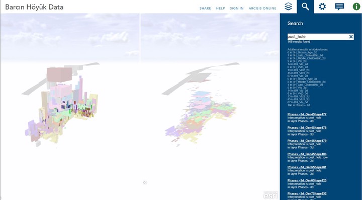
Abstract
Presentation of a fully functional 2.5D model, as well as a digital elevation model of Barcın Höyük. This model was created for the Barcın Höyük excavation symposium in 2016. It is based on top and bottom elevations of excavated contexts, during 7 years of the project. The model was created by using ArcScene, CityEngine web viewer and runs on OpenGL. Open the full viewer for better controls and guidelines.
Type
Publication
Overview of the Barcın Höyük excavations project’s AIS (Archaeological Information System); contributions from 2013 to 2016).
Petrus J. Gerrits
PhD Student
My research interests include Geographic Information Science, Archaeology, Network Analysis and Computational Methods in Humanities.